Donate!

Showing posts with label gradient. Show all posts

Tuesday, May 17, 2016

Sea Breeze / Land Breeze Circulations

Sea/Lake Breeze Front is a boundary that is usually small and temporary but usually causes an abrupt drop in temperature as it passes (a distinct boundary between the cooler maritime air and the continental air it displaces). Whereas, just a sea/lake breeze is heating over the inland area which causes air to expand upward and diverge at higher altitudes. This creates a surface low-pressure area and the sea breeze flows inland from the sea.
Pressure starts out equal over the land and sea/lake but due to unequal surface heating. The land is warmer due to the ground absorbing heat faster than the sea/lake, resulting in the ground heating the air by conduction. The less dense, warmer air is rising and expanding thus increasing the upper-level pressure and creating divergence above while, decreasing the pressure over the land. Whereas, over the sea/lake, the cooler and denser air which has a relatively higher pressure resulting in low-level convergence due to the fact that air flows from high to low pressure (pressure gradient force).
The strength of the breeze depends on the strength of the land-sea temperature difference (gradient). Sea/lake breezes occur mid to late afternoon when the land-sea temperature difference (gradient) is greatest and tend to be more intense than land breezes. Although, thunderstorms may develop if atmospheric instability is enhanced by surface heating.

Land breezes, on the other hand, are a reverse circulations that tend to occur during the pre-dawn hours. At night, the land surface cools more rapidly than the sea thus becoming denser resulting in a higher surface pressure and an offshore flow.

The Hydrostatic Equation

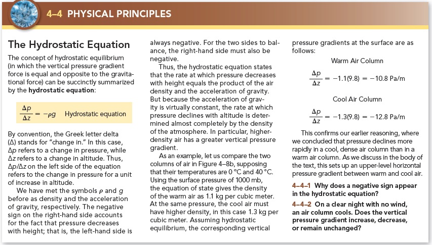
Hydrostatic Equation:

Hydrostatic Balance is when the net upwards force is equal to the downward force, requiring that the balance of forces in the vertical…
The pressure at height, z, is equal to the weight of the air in the vertical column of unit cross-section lying about that level.

Hydrostatic Equilibrium is when vertical pressure gradient force and the force of gravity are normally of nearly equal value and operate in opposite directions when…
     Gravitational force = vertical pressure gradient force in magnitude à no vertical acceleration occurs
     Gravitational force > vertical pressure gradient force à downward motion
     Gravitational force < vertical pressure gradient force à updrafts can develop that are associated with powerful thunderstorms.


Gradient Winds

Gradient Wind (or flow) develops only in the absence of friction, when considering curved flow and flows perpendicular to the contours, for the same reason as in geostrophic flow. However, gradient wind is not truly geostrophic because it is constantly moving, thus undergoing an acceleration. Nonetheless, this time, in order for the air to follow parallel to the contours there must consider the effects of the centrifugal force as well as the pressure gradient force and the Coriolis force.

Subgeostrophic Flow is when V < Vg, air curves cyclonically (counter-clockwise), and the CF needs greater than in the geostrophic case in order to balance the PGF.


Supergeostrophic Flow is when V > Vg, air curves anti-cyclonically (clockwise), and the CF does not need to be as great as in the geostrophic case in order to balance the PGF.

Putting it all together…


Geostrophic Wind (and Equations)

Geostrophic Wind is a nonaccelerating flow occurring only in the upper atmosphere (due to the lack of friction) and when the winds are considered at “steady-state” (when the PGF counterbalances the CF). In fact the geostrophic flow is simply a special case of gradient flow that arises when the wind flows parallel to the isobars.


Monday, July 20, 2015

Weather Maps--The Surface Station Model and Surface Weather Maps


Ø  The Surface Station Model and Surface Weather Maps
̶        Temperature, pressure, moisture, and wind measurements are reported hourly at the surface (most are usually made 2 meters above the ground)
̶        Station Model:

·         Isobars: Lines of constant pressure
·         Pressure Gradient: Where pressure changes over distance
·         Temperature Gradient: rapid change in temperature with distance

·         Isotherms: Lines of constant temperature